| Feb 18, 2010 |
Station's ENVISAT ASAR Image Archive Coverage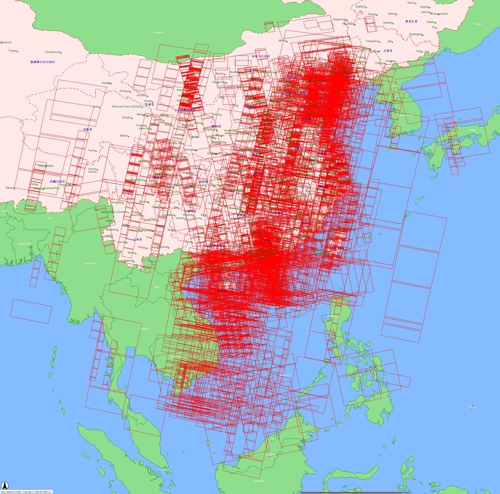 Our Ground Receiving Station's ENVISAT ASAR archive coverage from Oct 2005 to Feb 2010. |
||||||||
| April 19, 2008 |
ENVISAT ASAR Typhoon Image
 Detail... |
||||||||
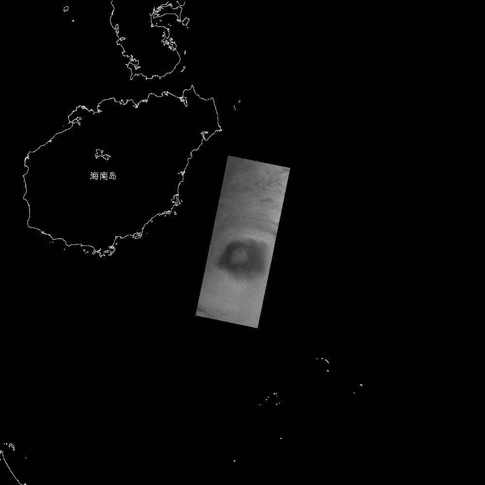
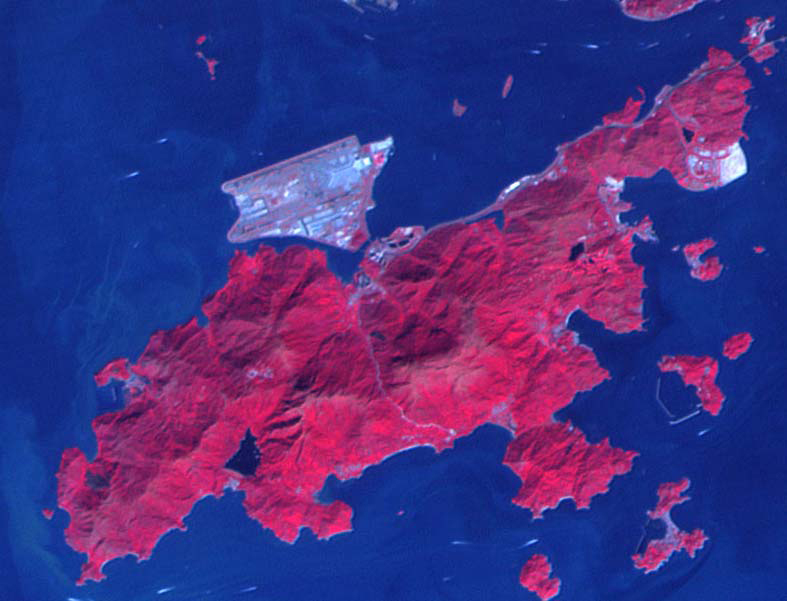
| April 2, 2008 |
Oil Spill in South China Sea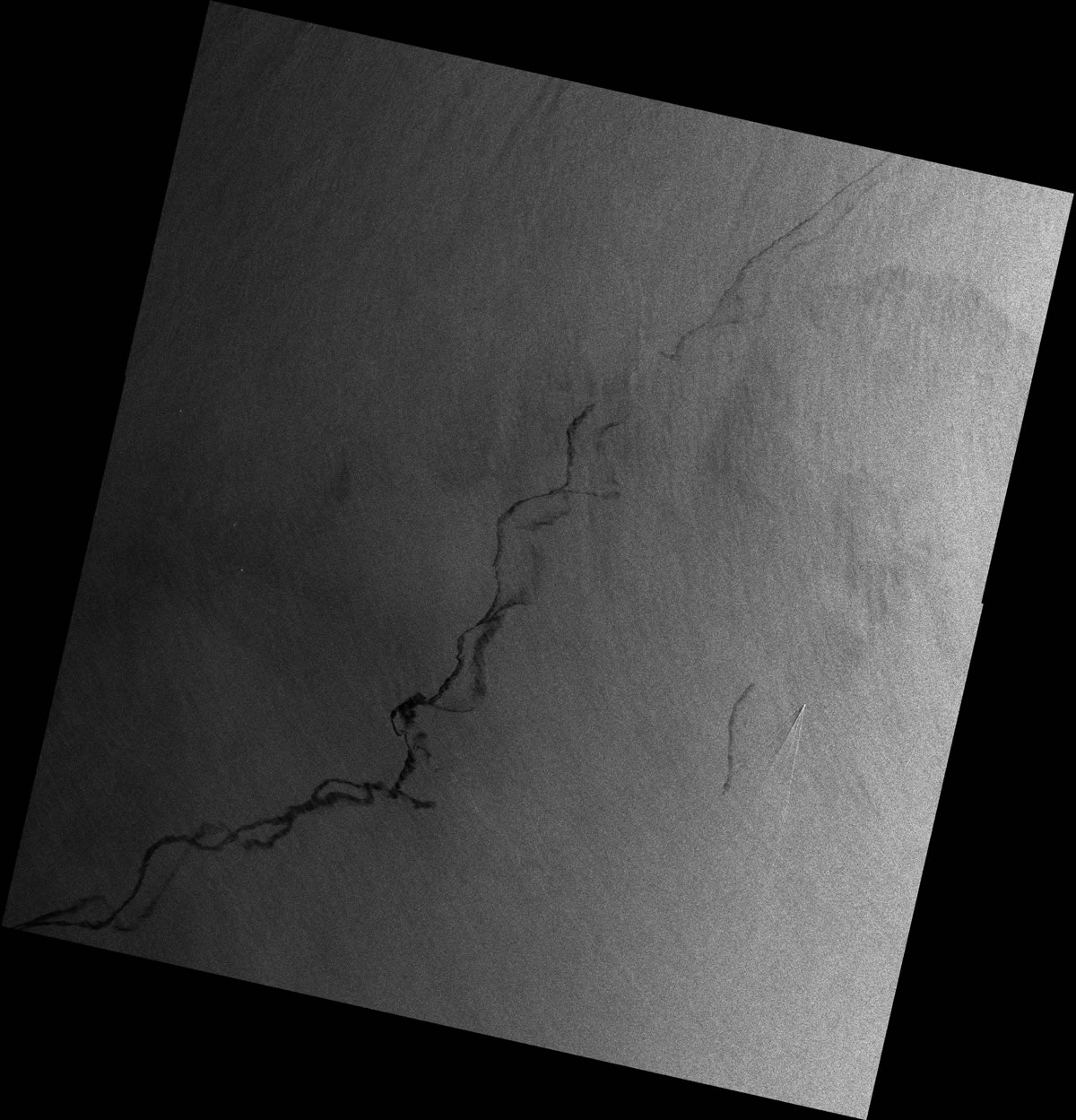
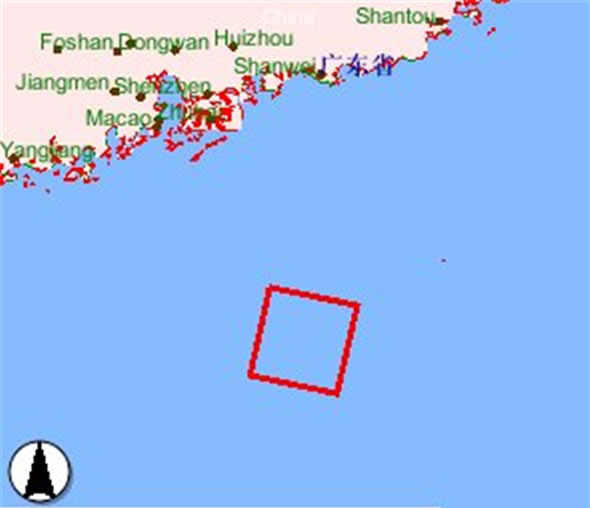 Detail... |
||||||||
| Nov 30, 2007 |
Hill Fire in Hong Kong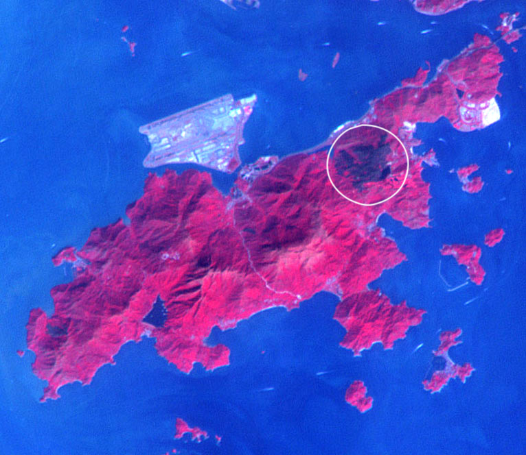
 Detail... |
||||||||
| Aug 4, 2007 |
Pearl River Delta Environmental survey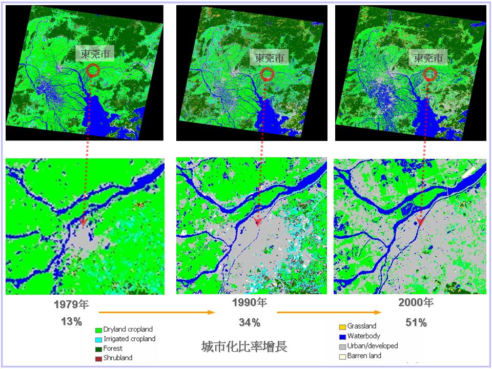   Research the impact on Pearl River Delta environment by urban development. more... |
||||||||
| Aug 3, 2007 |
Monitor oil spill by ENVISAT ASAR image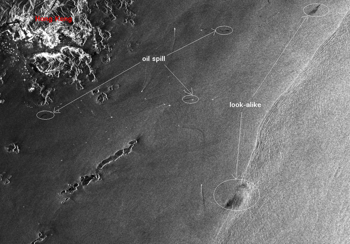 Through investigating ENVISAT ASAR image on June 5, 2007, our station discovered the oil spill around Hong Kong. more... |
||||||||
| Jul 20, 2007 |
Anhui Province satellite image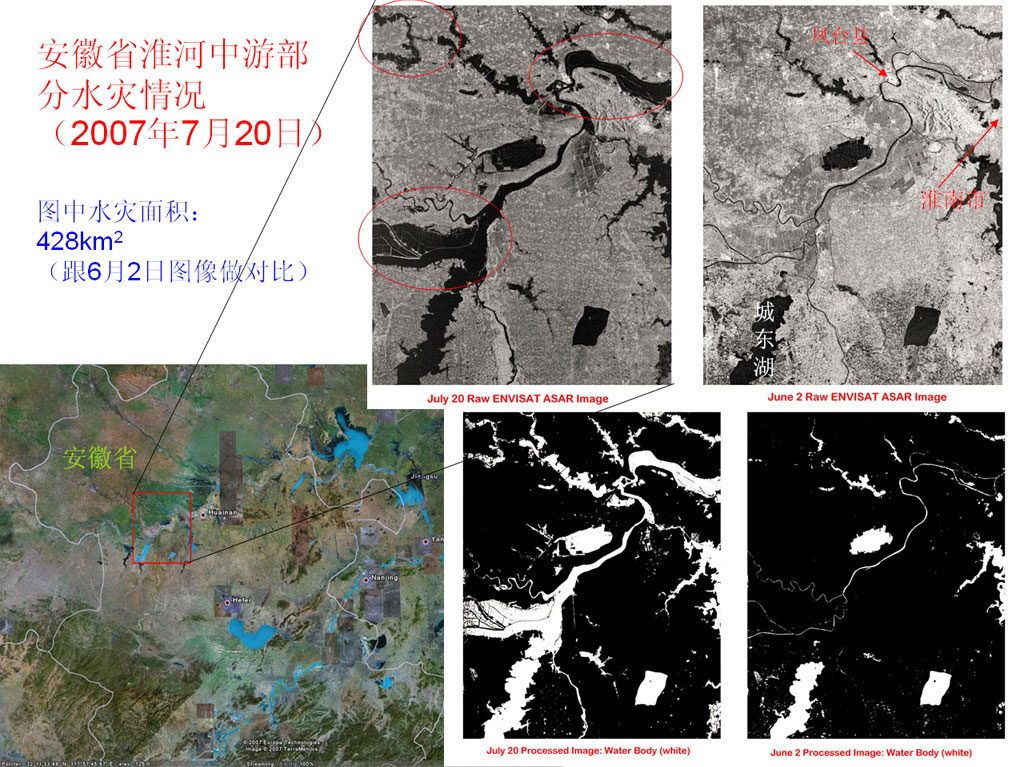 ENVISAT ASAR image on July 20 showing part of Anhui Province's flooding situation |
||||||||
| Jul 10, 2007 |
Shanghai and SuZhou satellite image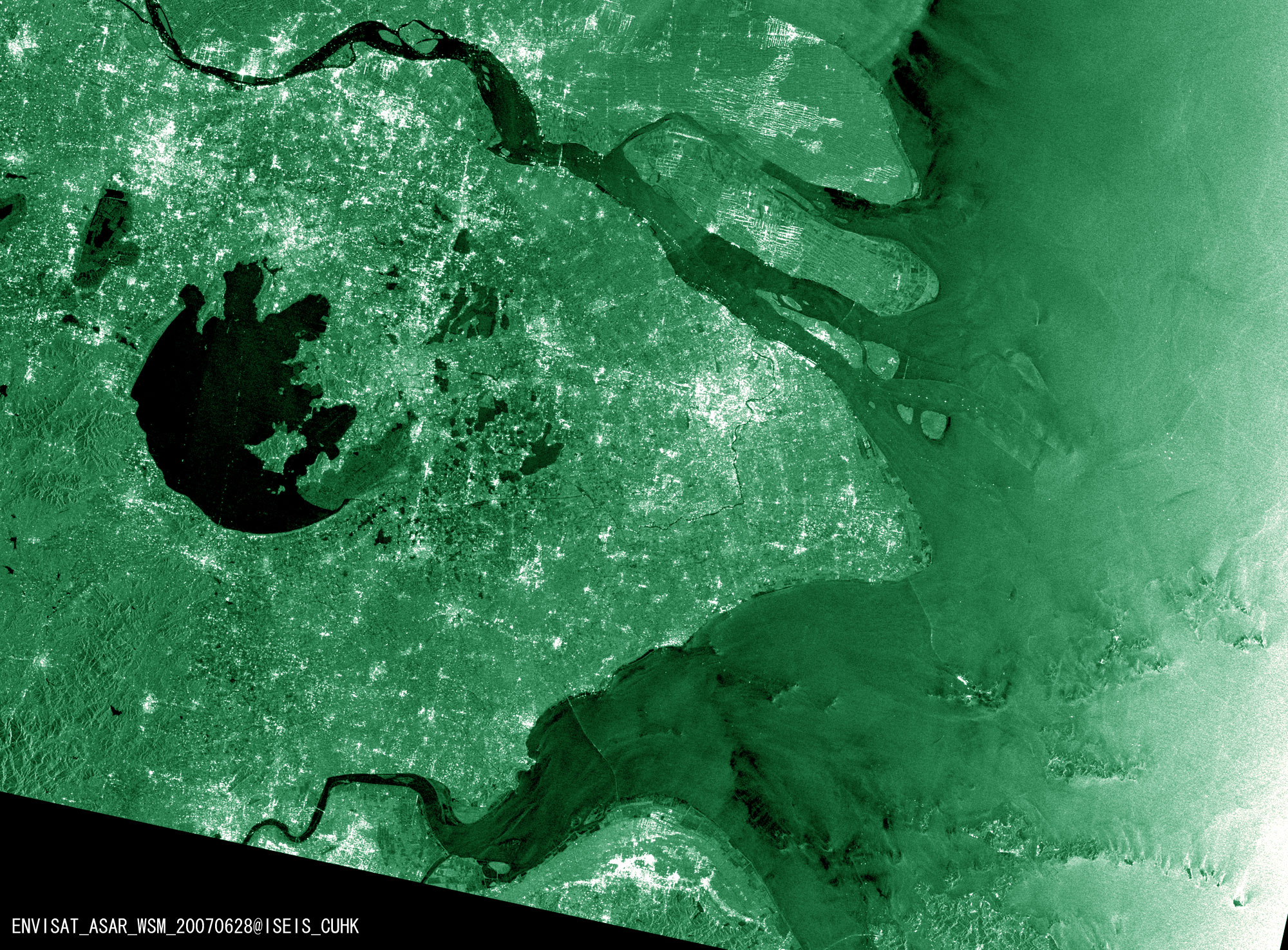 ENVISAT ASAR image on June 28 2007 showed the area of Shanghai, SuZhou and TaiHu, etc… |
||||||||
| Dec 14, 2006 |
Oil Seepage
|
||||||||
| Dec 10, 2006 |
Monitoring change of area of Poyang Lake through ENVISAT/ASAR images
|
||||||||
| Nov 26, 2006 |
Monitoring Nan Hai's Internal Wave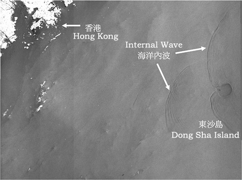 On 20 November, 2006, gorund station received a satellite image about Nan Hai's internal wave. From the image, we can notice the accurate location. The location is around Dong Sha Island, where is about 300 kilometers distant from Hong Kong. more... |
||||||||
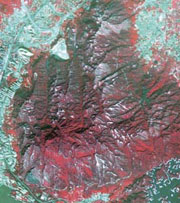
| Nov 24, 2006 |
Hillfire in Tai Lam
[Mingpao News] The biggest ever hillfire in the last decade in Hong Kong has blazed large area of forest in Tai Lam Country Park. Satellite images captured by the Yuen Yuen Research Centre for Satellite Remote Sensing of The Chinese University of Hong Kong in collaboration with Taiwan University indicate that this recent hillfire has destroyed almost 740 hectares of tree, which shows discrepancy with the number of 460 hectares published by AFCD (Agriculture, Fisheries and Conservation Department). Researchers compared satellite image of the country park at 17 December 2005 (before the hillfire) with that taken at 12 November 2006 (after the hillfire) and delineated the area of destruction (red area representing vegetation and black area is the blazed area). Preliminary computer analysis showed that the hillfire resulted in great-area destruction of about 740 hectares. However, verification of the actual destruction area and species of tree burnt down have to be carried out by field survey. AFCD declared early that the area of forest blazed by hillfire at Tai Lam Country Park was 460 hectares, and all 6,650,000 trees involved were within buffer zone. The kernel part of the country park with high ecological value has not been affected by the hillfire. AFCD, FSD (Fire Service Department), CAS (Civil Aid Service) and GFS (Government Flying Service) have sent out about 600 mantime for firefighting, and finally the hillfire went out after 46 hours of burning. |
||||||||
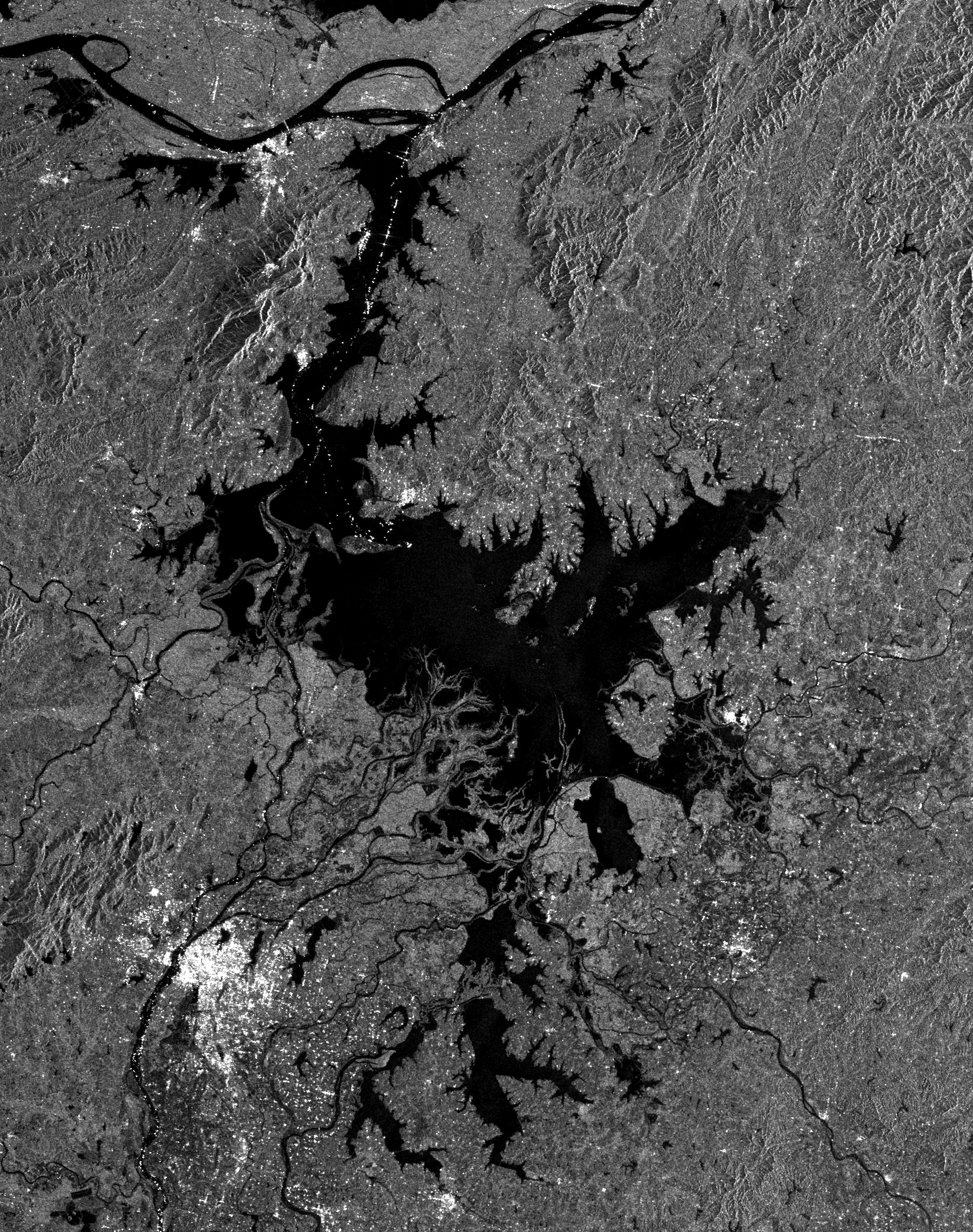
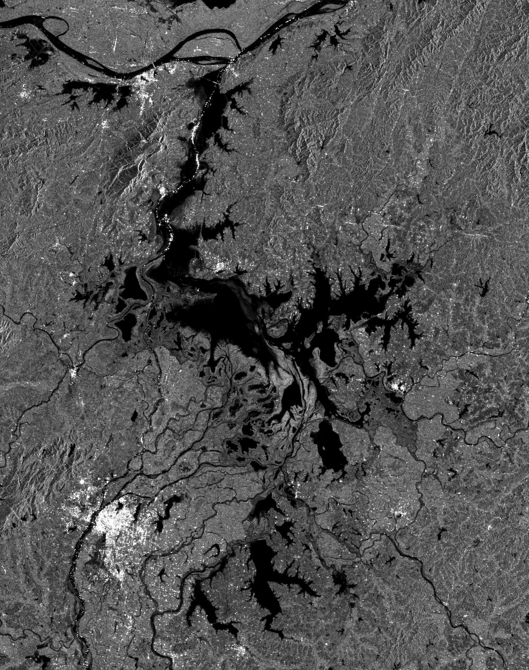
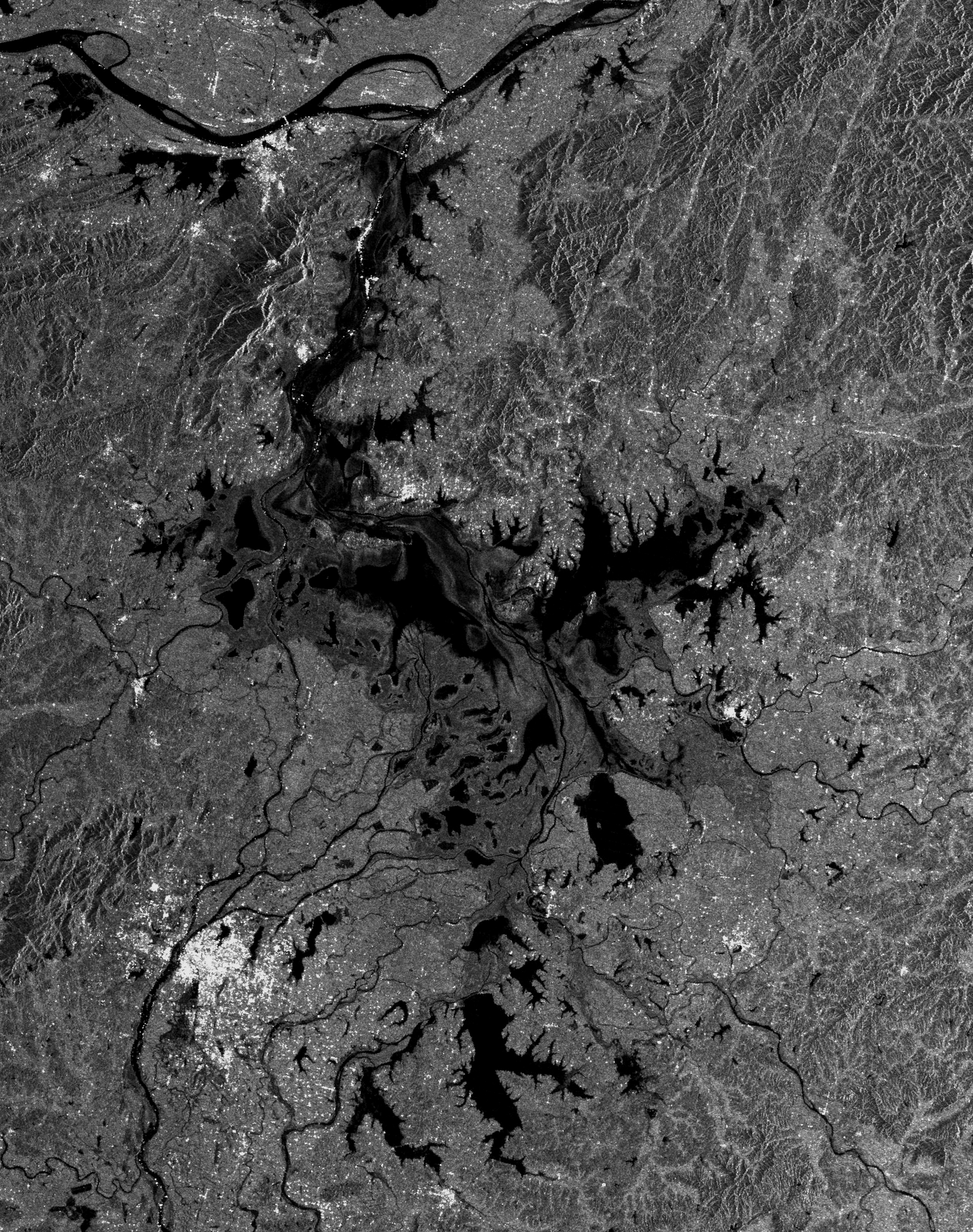
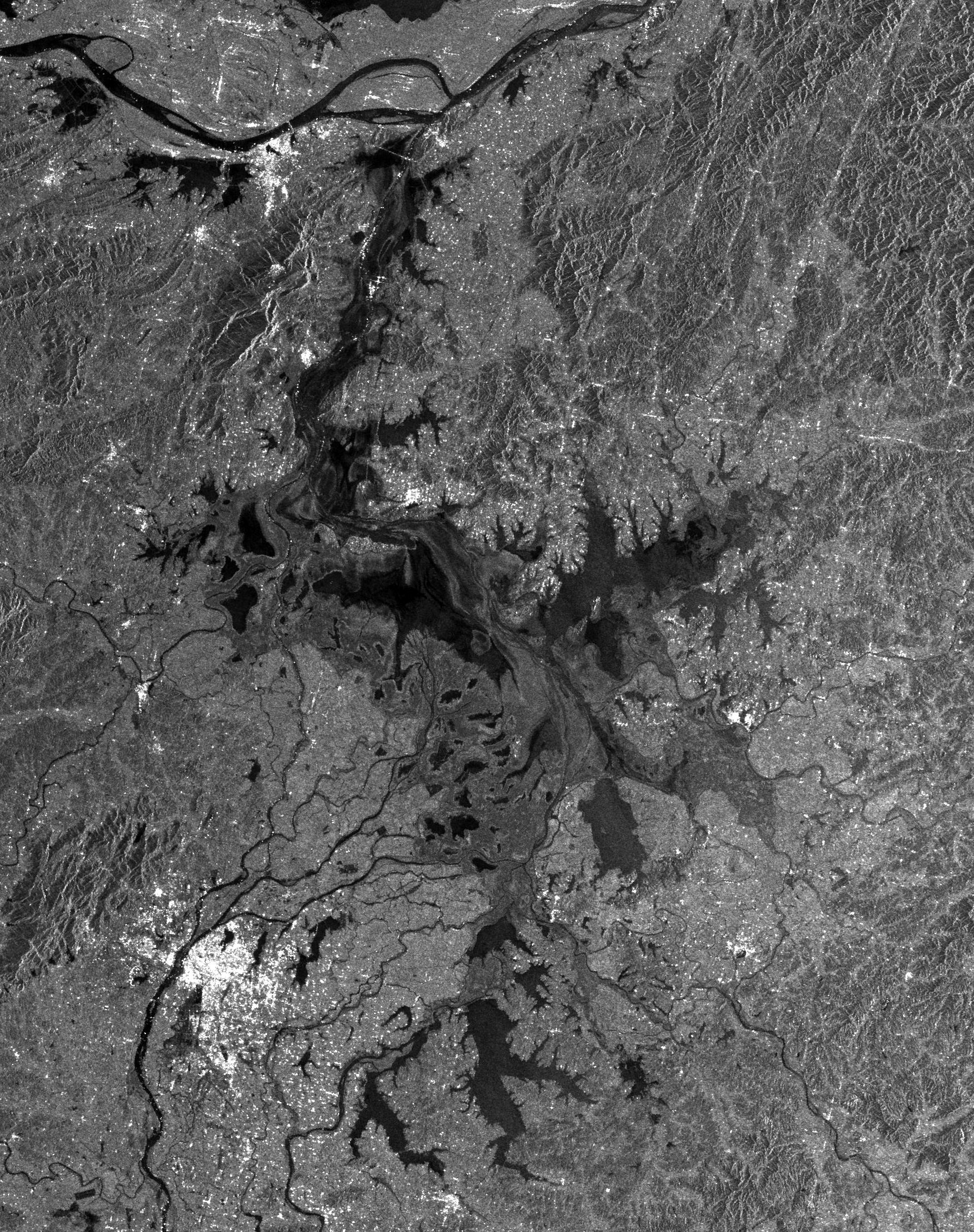
| Nov 21, 2006 |
Dongting Lake dries up rapidly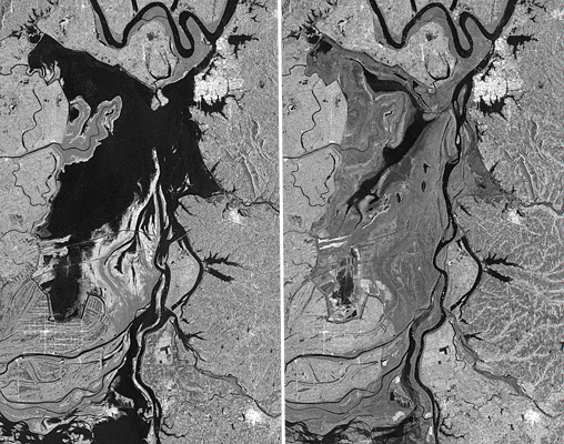 [Mingpao News] Dongting Lake, the second largest freshwater lake, is drying up rapidly due to impact of durative drought in the past a few months. In the lake area vast lakebed has become desiccated barren land, which may cause ecocatastrophe and was guessed to be related with impoundment in the Three Gorge Dam. From July to October in this year, four satellite images over Dongting Lake were received by the CUHK Satellite Remote Sensing Receiving Station. In these satellite images, dark tone means water body, grey tone represents land, and bright tone corresponds to towns and human settlements. By comparing images of July and October, we can see clearly the large-area drying up in Dongting Lake region. The drought area in the region was estimated to be about 430 km2 (40% of Hong Kong area). These data can be provided to local authorities in charge of water resources as a tool for drought monitoring. |
||||||||
| Oct 14, 2006 |
Oil Pollution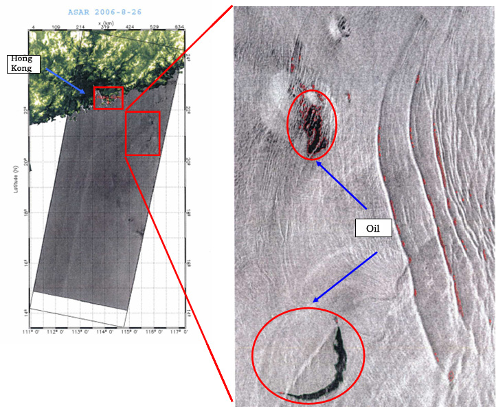
|
||||||||
| Aug 14, 2006 |
"Delievering satellite image of East China after the passage of Typhoon SaoMaimore... |
||||||||
| Jul 19, 2006 |
"Delievering satellite image of Guang Dong after floodingmore... |
||||||||
| Oct 5, 2005 |
Inauguration of the First Phase of the Satellite Remote Sensing Receiving Station and the Institute of the Space and Earth Information Science of The Chinese University of Hong KongVideo: |