The cryospheric remote sensing team led by Prof. Lin Hui, Director of the Institute of Space and Earth Information Science (ISEIS) at The Chinese University of Hong Kong (CUHK), recently conducted the world’s first large scale glacier mass balance survey in the western part of ‘High Mountains Asia’, including the Tibetan Plateau, the West Kunlun, the Karakoram, the Hindu Kush and Pamir. This research helps scientists understand more about the ‘Karakoram anomaly’, and provides essential data for glaciology research and the prevention of glacier-related hazards. The research article has been published online in Scientific Reports.
‘High Mountains Asia’ sees the largest distribution of low-latitude high-altitude glaciers, which are water source and essential buffer against drought for Southern Asia and Central Asia. In recent years, the speed of ice melting has increased due to rising temperatures worldwide. However, the volume of glacier in the Karakoram area has increased, which contradicts the global trend. This phenomenon is known as the ‘Karakoram anomaly’. From the past to the present, glacier mass balance is usually measured by in-situ observations, laser altimetry or photogrammetry. Due to a lack of continuous and accurate observation over the vast area, the glacier mass balance pattern in the western part of ‘High Mountains Asia’ and whether the ‘Karakoram anomaly’ is located in the Karakoram or in the West Kunlun and its boundary have been matters of debate for a long time.
Prof. Lin Hui’s team applied the latest interferometric techniques to high resolution radar satellite imageries captured from 2011 to 2014 and terrain data collected in 2000, to study the glacier mass balance. They found a decreasing gradient from the southwestern edge of the Tarim Basin to the Karakoram, which indicates that the volume of glacier is reducing at the southern Karakoram but increasing at the southwestern edge of the Tarim Basin. The study also showed that the ‘Karakoram anomaly’ is centered at the West Kunlun, which is the divide between the Tibetan Plateau and the Tarim Basin. The drainage divide between the Indus Basin and the Tarim Basin, which is also the main ridge of the Karakoram, seems to represent the limit of this mass balance anomaly.
Three anonymous reviewers of the research article believed that the research is the most spatially complete and accurate measurements of glacier mass balances for the western part of ‘High Mountains Asia’ to date, and provides essential data for later research on glaciology and the numeric modeling of climate. The observation data provided by Professor Lin’s team will also be essential for coupled cryo-hydrological model establishing, international water source management and forecasting. This dataset can also provide important references for hazard prevention, such as glacier lake outburst flood (GLOF), glacier surging and glacier calving.
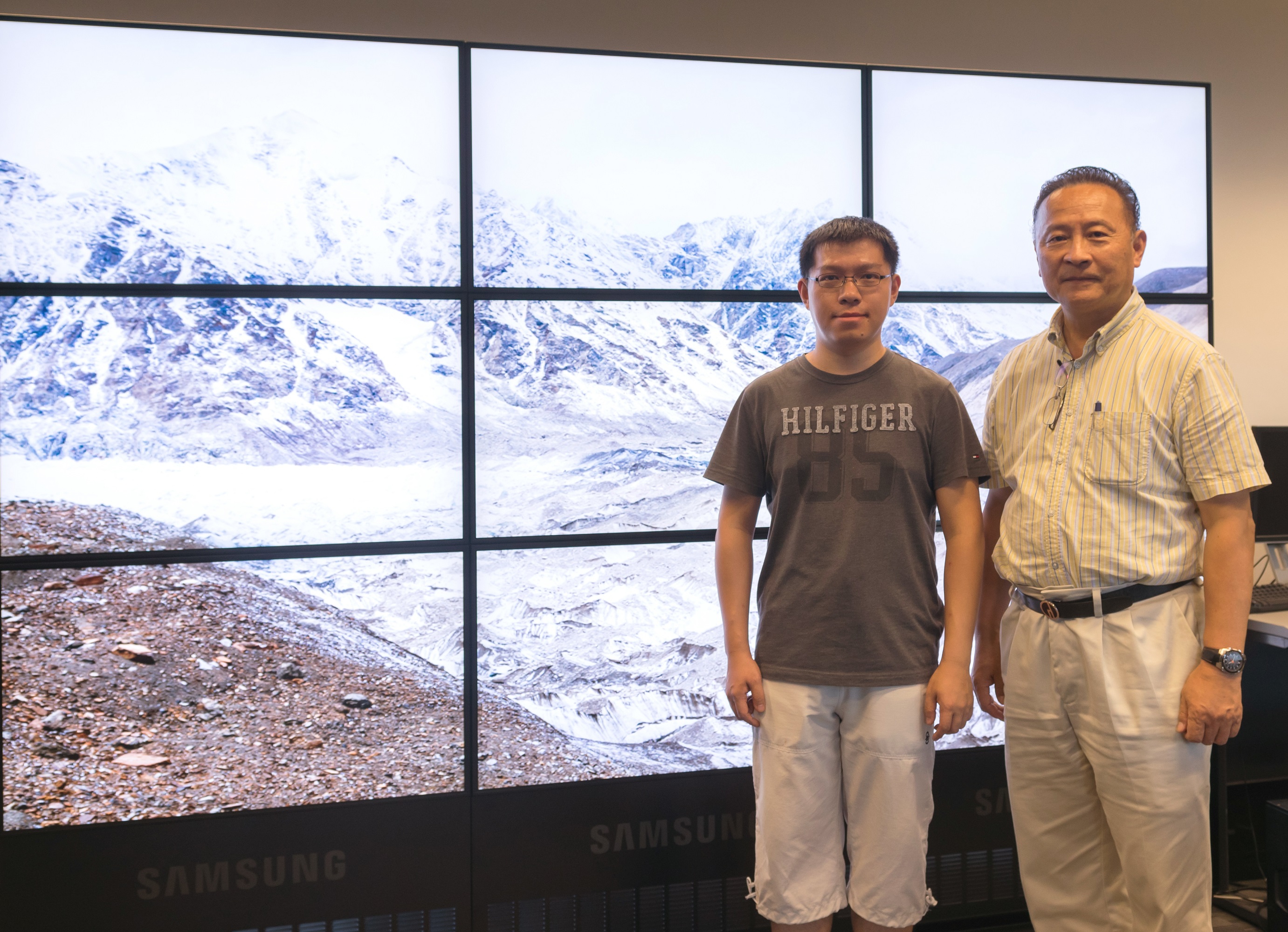
Prof. Hui Lin (right) and Dr. Gang Li, member of the team.
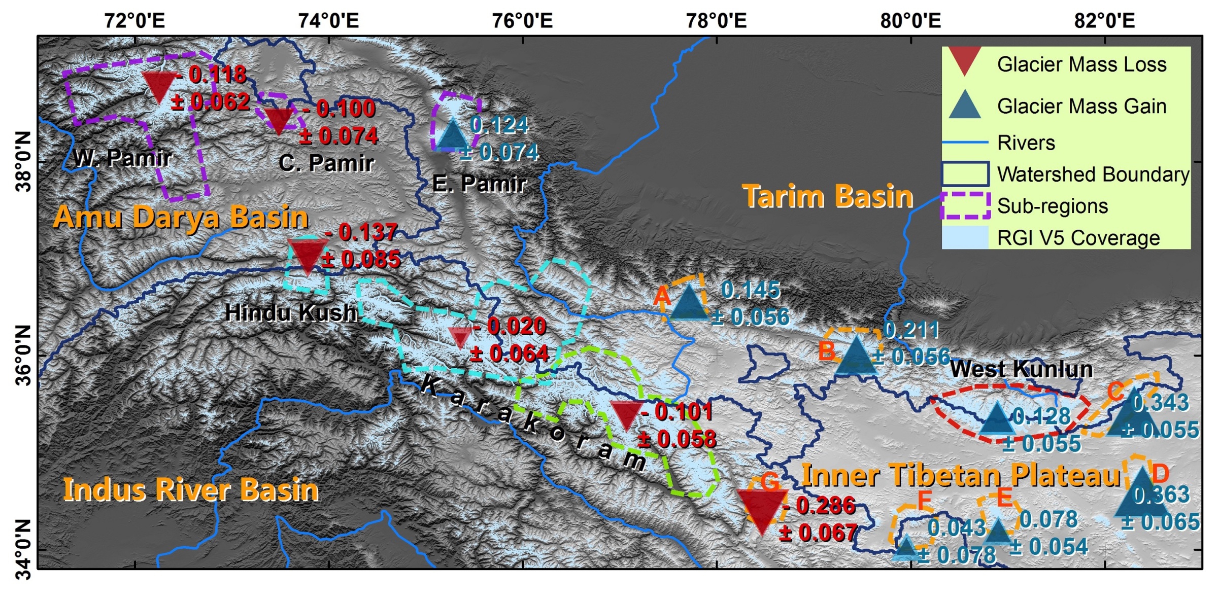
Glacier mass balance (in terms of m w.e. (water equivalent) yr-1) in the Karakoram and its surroundings during 2000 ~ 2014.
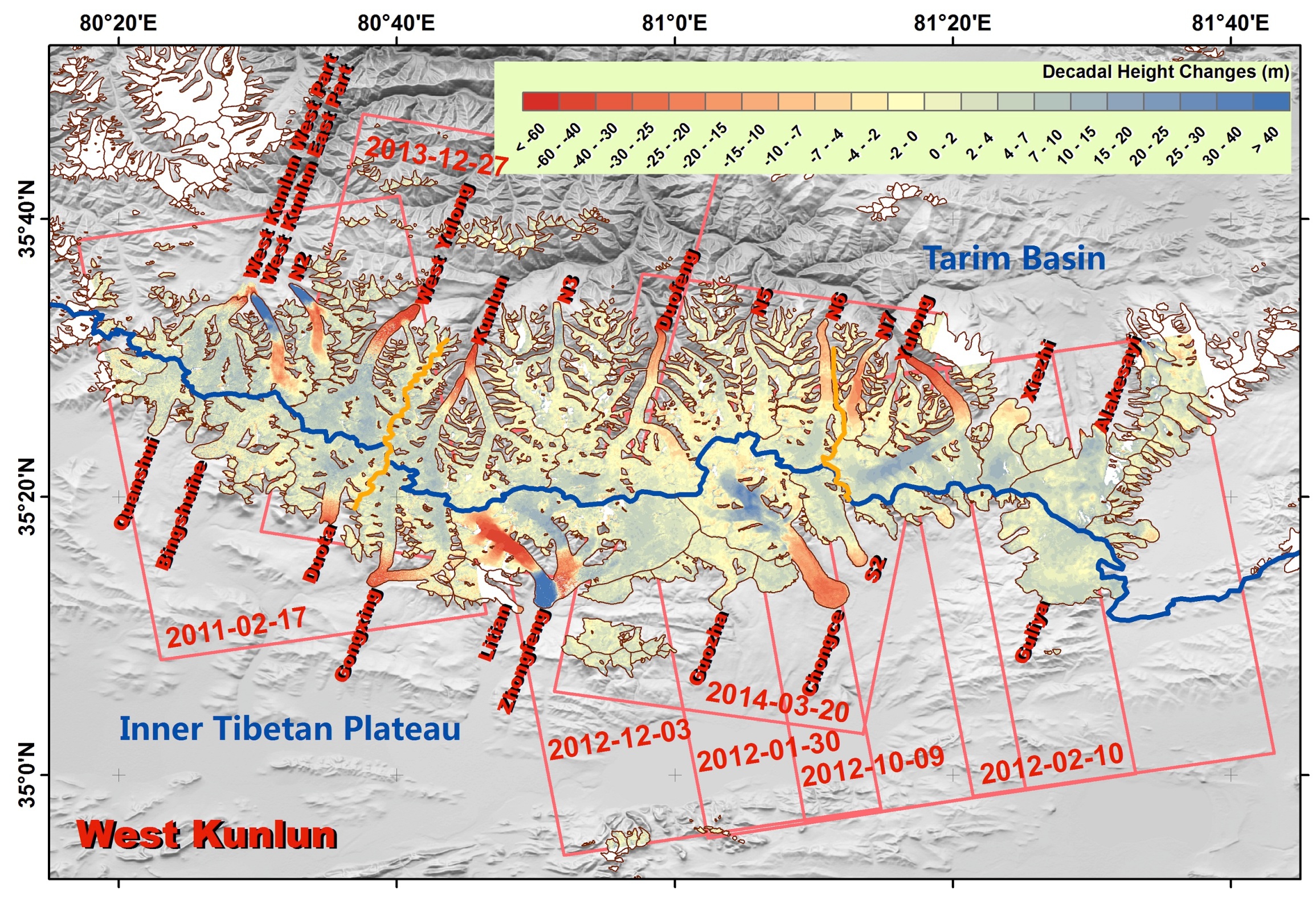
Glacier height changes during 2000-2014 for the West Kunlun. Rectangles present radar images acquisition time and their coverage. The blue line indicates the drainage divide between the Tibetan Plateau and the Tarim Basin.